GeoAstra
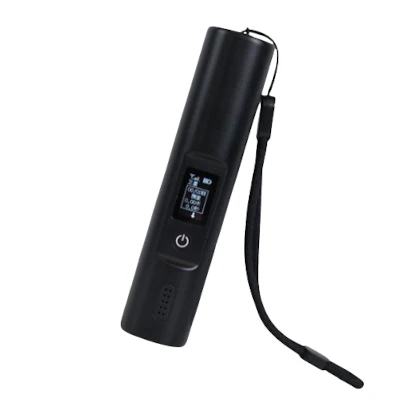
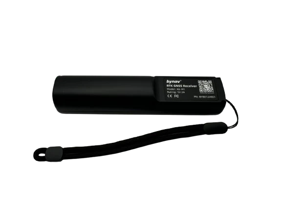
GeoAstra X8-M1 Lightweight RTK GNSS Receiver (L1, L2 & L5 bands, 4G LTE, Bluetooth / USB Dual Interfaces, IP67 waterproof, 20-hour battery life, ultra-portable at only 104g, 50 cm accuracy standalone, up to 1 cm accuracy with RTK)
GeoAstra X8-M1 Lightweight RTK GNSS Receiver (L1, L2 & L5 bands, 4G LTE, Bluetooth / USB Dual Interfaces, IP67 waterproof, 20-hour battery life, ultra-portable at only 104g, 50 cm accuracy standalone, up to 1 cm accuracy with RTK)
Couldn't load pickup availability
GeoAstra X8-M1 is a compact yet powerful RTK Bluetooth and USB GNSS receiver, delivering 1 cm accuracy with RTK

and 50 cm accuracy by standalone (without RTK).

Lightweight and ultra-portable at only 104g, it is designed for versatility and precision. The X8-M1 supports full-constellation —including GPS, GLONASS, BeiDou, Galileo, QZSS, and SBAS—across L1, L2, and L3 frequency bands, ensuring robust performance in all conditions.
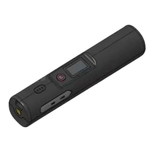
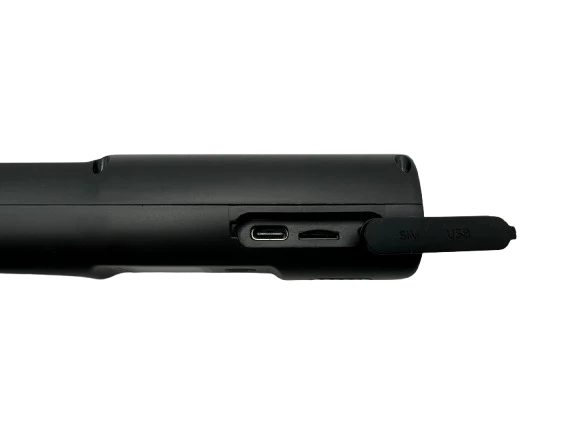
With an IP67 waterproof and dustproof rating, the X8-M1 is engineered to withstand challenging environments, providing up to 20 hours of uninterrupted operation. The device is equipped with Bluetooth and USB dual interfaces, allowing seamless data sharing with Android, Windows, and Linux devices. For enhanced connectivity, a built-in 4G LTE SIM slot enables independent access to CORS RTK correction data or, alternatively, downloads CORS data through a device’s internet connection via Bluetooth.
Flexible in its application, the X8-M1 can be worn on the shoulder, attached to a helmet, mounted on vehicles, or secured to a survey pole, making it ideal for a wide range of high accuracy positioning needs.
Key Features:
Compact and Portable
The X8-M1 features an all-in-one, lightweight design (104g), making it easy to operate with one hand. Its wearable design connects seamlessly to smartphones, tablets, and other devices via Bluetooth, ensuring compatibility with a wide range of apps and software requiring high-precision positioning data.
Reliable and Durable
Engineered to withstand drops of up to 2 meters on a survey pole and 1.5 meters as a standalone device, the X8-M1 is built for resilience. With its IP67-rated waterproof and dustproof protection, it is designed to perform reliably in demanding environments.
Extended Battery Life
With low power consumption of just 0.6W, the X8-M1’s built-in 3300mAh battery delivers over 20 hours of continuous operation, reducing the need for frequent recharging.
Smart Configuration
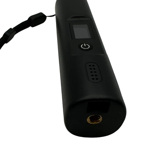
Equipped with an OLED screen, the X8-M1 provides real-time display of positioning data, status, battery level, and more. A backlit function button shows current positioning status for easy recognition.
Easy Integration and Development
Supporting MQTT, HTTP and TCP protocols along with repeat transmission capabilities, the X8-M1 also offers Bluetooth and USB-C virtual serial port output with real-time network transmission, making system integration straightforward and efficient for clients.
Technical Specifications
Network Transmission
• Supports 4G transmission
Data Update Frequency
• Supports up to 10 Hz
GNSS Performance
• BDS-2: B1I, B2I, B3I
• BDS-3: B1I, B1C*, B2a, B2b*, B3I
• GPS: L1 C/A, L1C*, L2, L5
• GLONASS: G1, G2
• Galileo: E1, E5a, E5b, E6*
• QZSS: L1 C/A, L1C, L2, L5, L6 (CLAS*)
• NavIC: L5
• SBAS: L1 C/A
RTK Positioning
• Positioning Accuracy (Open Space):
• Horizontal Accuracy: (1+1ppm) cm
• Vertical Accuracy: (1.5+1ppm) cm
• Fixed-solution Convergence Time: <10 s (Generally)
• Initialization Reliability: >99.9% (Generally)
• Output Rate of Positioning Result: 10 Hz
Protocols
• Differential Data Protocol: RTCM 3.3
• Output Protocol: NMEA 4.11, 4.10, 4.0, 2.3, 2.1
• NTRIP Protocol: Supports receiving differential data
• Bluetooth Protocol: BT 5.1 BR/EDR BLE
• Vitrual COM port: By USB
• Remote Maintenance: Supports remote configuration and OTA upgrades
Wireless Access
• Allows easy configuration via app
Power Supply
• USB Type-C input 5V/1A and supports wireless charging
Environmental Protection
• Waterproof & Dustproof: IP67
• Operation Temperature: -25°C to +80°C
• Humidity: 100% Non-condensing
• Anti-shock: Shock resistance for drops up to 1.5m
4G Network Frequencies
• X8-M1-US(North America Edition): LTE-FDD: B2/B4/B5/B12/B13/B66/B71
• X8-M1-EU/AS(Europe/Asia Edition): LTE-FDD: B1/B3/B5/B7/B8/B20/B28
Mechanical Specifications
• Material: ABS flame-retardant plastic
• Size: 133mm (H) x 32.6mm (W) x 30mm (L)
• Interface: Type-C supports USB communication
ByCenter Software
(The ByCenter app was previously called GBoxTools. Some of the screenshots below may still display the word “GBoxTools”; simply replace “GBoxTools” with “ByCenter.”)
The GeoAstra X8-M1 comes with ByCenter software, designed for the Android system. Currently, it is not available on the Google Play Store but can be downloaded as an APK file from our website and manually installed on your Android device.
Once installed, ByCenter connects to the X8-M1 device via Bluetooth and offers five main functions:
• Display current working status, including latitude, longitude, satellite count, accuracy, satellite status, and more.
• View and configure device settings, such as NTRIP IP and port.
• Detect device issues, including SIM card problems or network cable faults.
• Perform Bluetooth firmware upgrades.
• Act as a Mock Location app for the Android OS.


Package content:
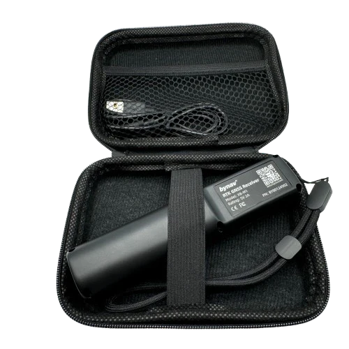
- X8-M1 main device
- USB-C cable
- Carrying and storage case
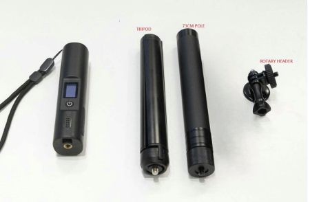
- Lightweight Aluminum Telescopic Rod + Tripod + Rotary Head (Optional Accessory)
The X8-M1 has a built-in 4G LTE SIM card slot compatible with North American LTE networks, though it does not include a SIM card or 4G service. Users can purchase their own 4G LTE service if needed. Note that 4G LTE service is optional, as CORS/NTRIP data can also be downloaded via Bluetooth using the internet connection of a connected phone, tablet, or computer.
* In the event of any discrepancy between the package contents listed on this webpage and those in the user manual, the user manual should be considered correct.

The optional accessory "Lightweight Aluminum Telescopic Rod + Tripod + Rotary Head" can be purchased by selecting the accessory option before adding it to the cart. For more details about this accessory, please check it out here.


Product Resources
Official Documents:
Tool Downloads:
How to Articles and Blogs:
-
 How to Set Up the GeoAstra X8-M1 Bluetooth GNSS receiver as an RTK Rover on Android Using the “Bluetooth GNSS” App?
-
 How to Set Up the GeoAstra X8-M1 Bluetooth GNSS receiver as an RTK Rover on Android Using the ByCenter App?
-
 How to Configure the GeoAstra X8-M1 in RTK Base Mode?
-
 How to connect a GPS/GNSS Receiver to Google Earth on Windows?
-
 Utilizing a USB/Bluetooth RTK GNSS Receiver with a Windows 10/11 Laptop: A Step-by-Step Guide
-
 How to Connect a USB/Bluetooth RTK GNSS Receiver to Windows? (Accessing NTRIP Through an Android Phone’s Internet Connection)
-
 Utilizing a RTK GNSS Receiver for Linux: A Step-by-Step Guide
-
 Utilizing a USB/Bluetooth RTK GNSS Receiver for High Accuracy Data Logging: A Step-by-Step Guide
